My Topographic Map
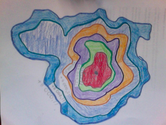
What is Topography?
Mapping with elevation.
What does a topographic map tell me, that other maps cant?
Topographic maps can tell me the elevation of mountains and others cant.
Who might use a topographic map?
Meteorologist, to see the weather at a different elevations.
Vocabulary
Elevation:
Height of a place relevent to a reference height.
Contour Lines:
A line connecting point that have the same elevation.
Contour Intervals:
The different elevation between two adjacent contour lines.
Depression Contour:
Contour lines indicates a downward slope.
